
Don’t BIG HORN Mine if I do
This little gem of a day hike is one of the more simple ones, but don’t let it’s simplicity fool you, it’s also a rewarding one. There are amazing views and endless areas to explore. It’s a great experience for the whole family and easy enough for the little ones. What kid doesn’t love mysterious mines and gold discovery stories? Total distance of 4 miles out and back and pets are allowed on a leash. Big Horn Mine, named after the elusive sheep that still roam the area, is the largest gold mine located in the San Gabriel Mountains. The area was discovered in the late 1800’s by Charles “Tom” Vincent. Gold was discovered and so began the mining operations. Although the mine remained open for only a few years, miles of extensive mine shafts were excavated deep into the mountain. This place has an interesting history. Read more about the History of Big Horn Mine here 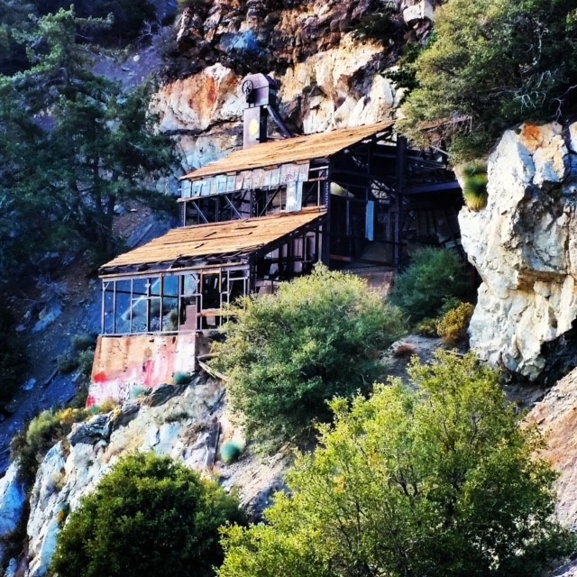 http://www.secretmines.com/p/big-horn-mine.html
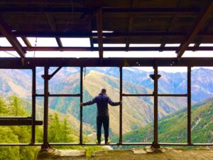
The hike itself is pretty straight forward and very easy to navigate. The trailhead to the mine is located off HWY 2, West of Wrightwood and South of Valyermo. Here’s the GPS coordinates to the trailhead 34.37313, -117.75199 coordinates can be copied and pasted directly in to any map program, handheld GPS or Google Earth. I personally use Google Earth to do all my pre-trip planning and then Apple maps once I arrive. Prior to arriving, I will screenshot and save images from Google Earth to my phone. This way, if I can not access any type of map, I always have these screen shots for my reference. Most GPS map apps will also allow you to select and download a grid of the area you are visiting, so you always have it handy. Ideally, if you are the adventurous type and frequently trekking outside of service areas, investing in a handheld GPS is always a smart idea. Anyways, on to the hike itself. You really can’t miss the trailhead location, as it’s a large parking lot. You will see the dirt trail to the West of the parking lot. This is your staring point. The trail itself is very easy to follow and will take you directly to the mine after a 2 mile hike. This area does have a good amount of wildlife viewing opportunity, so try to be as quite as possible while following the trail. Big Horn Sheep are native to this area, but are easily scared off by human activity. Last time I traveled this trail, a female deer ran across the trail directly in front of me. Close enough to give me a good scare. The trail follows a ridge in this valley area, definitely some good views and photo opportunities along the way. After 2 miles hiking in, you will come up to the mine itself. Most of the structure still exists, although it is slowly falling apart. Some great photo opportunities in the main structure looking out to the valley below. Nice panorama views for sure.
Don’t look down they say…
Be careful and cautious once you get to the mining structure, there is a lot of sharp metal and old building material that can give away at any moment. Behind the mining building you will find the actual mine entrance. There is a metal gate at the entrance, but enough of an opening to still get through. I don’t recommend going into the mine, I did, but I accepted the risks and was very prepared. Although there is no sign saying it’s prohibited to enter, enter at your own risk. These mines can be dangerous and there are obvious risks anytime you enter an old mine. There are also many vertical mine shafts that come out of nowhere and drop several hundred feet, straight down. Getting stuck or lost in here would not be a fun end to the day. There are approximately 6 miles of mine tunnels deep within the mountain. It’s a really neat location and an interesting part of the gold rush era. Although this is more of a day hike, the trail does continue on past the mine if you feel inclined to explore further or even spend a night and make it a backpacking trip. I don’t think many people venture on the trail past the mine itself. On your way back, as you start getting close to the parking lot, you will see a small trail that branches off the main trail to the right. This trail will take you down to Vincent’s Cabin. The old, abandoned cabin of the man who discovered and started the operations of Big Horn Mine. There are also stories of an old Cesna plane from the 60’s that crashed near the location of Vincent’s Cabin. I will leave this little side adventure for you to figure out, but not hard to find the cabin. One last note, directly across from the parking lot where you parked, is the famous Pacific Crest Trail. You should see the signs once you return to the parking lot. The Pacific Crest Trail goes all the way up to Canada, many people backpack this trail all the way from the Mexico border to Canada, totaling 2,653 miles and an average of 5 months to complete. How adventurous are you feeling today? Figured it wouldn’t hurt to point that out if you were looking for some camping options or wanted to say “I hiked (part of) the Pacific Crest Trail” I have been here several times and enjoyed these hikes. On the last one, I did notice a bit more trash than the previous trip and someone had added some ridiculous graffiti to the roof of the main mine building. Hopefully more effort can be made to keep this place clean and free of garbage others so conveniently leave behind. As I will say at the end of every post, please do what you can to keep these places pristine and help make them better if possible. Be respectful, hold others accountable and always leave no trace. If you need more info on best outdoor practices or the 7 Leave No Trace Principals, go check out www.LNT.org
WRIGHTWOOD WEATHER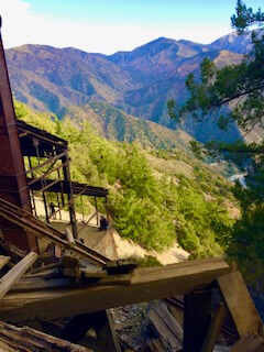
Top view of the mine. Also where the trail continues beyond the mine 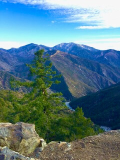
Taking a break along the trail to enjoy the scenery 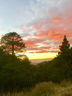
Looking out over the Pacific Crest Trail at sunset 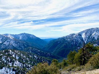
Trailhead views
Leave a Reply